
One of the Best Circular Hikes in Northern Pirin
✔ Four peaks above 2,500 metres
✔ Beautiful ridge walk
✔ Dautovo Lake
✔ Excellent panoramic views
✔ Blagata Voda Spring
✔ Chance to spot wildlife
Climbing Pirin Peak (2,593 m) is already a demanding mountain adventure. Turning it into a full-day circular hike that also includes Pleshki Peak, Bezimenen Peak, and Dautov Peak transforms the route into one of the most challenging and rewarding hikes in the northern part of the Pirin Mountains.
These four peaks form a spectacular ridge above the Struma Valley, offering endless panoramic views, rugged marble landscapes, quiet mountain cirques, and long stretches of untouched wilderness. Unlike the busy trails around Vihren, this route remains relatively uncrowded, making it perfect for hikers looking for a more authentic mountain experience.
Although we climb Pirin Peak almost every year—after all, it has become something of a symbol for hikers from Blagoevgrad—we hadn't completed this entire circular route since 2019. Every summer we talked about doing it again, but somehow always ended up hiking only to Pirin Peak before returning the same way.
This time we finally committed to completing the entire loop.
Route Overview
This hike starts from Kulinoto, near Predela Pass, and follows the standard trail to Pirin Peak before continuing along the main ridge over Pleshki Peak, Bezimenen Peak, and Dautov Peak. The descent passes by Dautovo Lake before joining the famous E4 European Long Distance Path, eventually returning to the starting point.
Route Statistics
Starting Point: Kulinoto
Distance: approximately 22–23 km
Elevation Gain: around 1,600 m
Highest Peak: Dautov Peak (2,597 m)
Difficulty: Very Difficult
Estimated Hiking Time: 9–11 hours
Best Season: June to October
Water Sources: Blagata Voda Spring and, depending on the season, Dautovo Lake
Although the ascent to Pirin Peak is physically demanding, the ridge traverse that follows requires even more energy. Long sections of rocky terrain, dense dwarf pine, and exposed mountain ridges make this a hike suitable only for experienced and well-prepared hikers.
Hiking to Pirin Peak
There are several established routes to Pirin Peak. The three most popular begin from Kulinoto, Moravitsa Hut, and the village of Senokos. Another, slightly longer option starts from Yavorov Hut.
Among them, the route from Kulinoto is both the shortest and the most convenient, especially if you're planning the full circular hike. The trail to Dautov Peak also begins from the same area, making it the ideal starting point for completing the loop.
Depending on your fitness level, reaching Pirin Peak usually takes between three and five hours.
An Early Start from Kulinoto
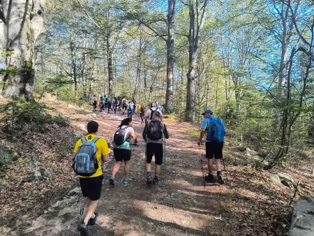
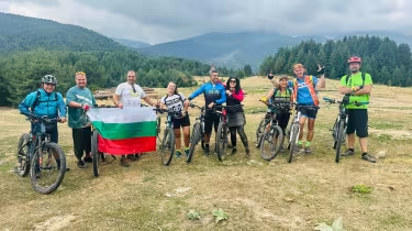
On this particular Sunday we gathered an unusually large group—twenty hikers in total. Sixteen had travelled from Petrich, while only four of us were from Blagoevgrad.
We met at Kulinoto at 8:30 in the morning. As always with a large group, getting everyone organized took a little time, so it was almost 9:00 a.m. before we actually started hiking.
The first four kilometres follow a wide forest road. It isn't the most exciting part of the route, but it serves an important purpose. The gentle gradient allows your body to warm up gradually before the much steeper climbing begins higher in the mountain.
We covered this section in just over an hour while enjoying the cool morning air beneath the forest canopy.
Into the Forest
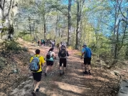
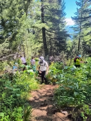
Considering we were a group of twenty people—including an eight-year-old girl—we maintained a surprisingly good pace. Nobody was left behind, and we reached the point where the hiking trail leaves the forest road together.
After a short break, the real climb finally began.
The trail immediately becomes steeper as it winds through a beautiful conifer forest. During summer, the ground is covered with blueberry bushes, although they don't usually ripen until August.
A few hundred metres higher, the trail from Predel Hut joins our route, marked with blue trail markers. From here, the ascent alternates between steep sections and gentler terrain, making the climb feel less monotonous.
One detail I always enjoy on this part of the route is the abundance of Macedonian pine (Pinus peuce). This Balkan endemic species is easy to recognize by its soft, flexible needles, which feel completely different from the sharp needles of most other pine trees.
An Unexpected Encounter
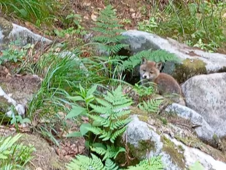
One of the highlights of the day came long before we reached the summit.
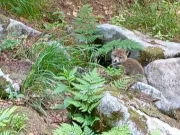
As we passed a rocky section beside the trail, we noticed several natural cavities formed between large boulders. Suddenly, a tiny fox cub burst out from one of them.
At first it ran away in obvious panic. Then curiosity got the better of it.
The little fox stopped, turned around, and watched us from a safe distance. Apparently it realized we posed no threat, and for several unforgettable moments we simply looked at each other.
Only later did we learn that there had actually been a second cub hiding among the rocks, although I never managed to spot it myself.
Encounters like this are a reminder that, despite the popularity of Pirin National Park, large parts of these mountains remain truly wild.
Blagata Voda Spring
Continuing uphill, we crossed the first section of large stone moraines. Fortunately, this initial rocky passage is relatively short.
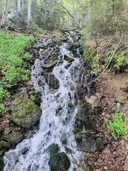
About one hundred metres higher lies the last reliable water source on the entire route—Blagata Voda ("Sweet Water") Spring.
A convenient pipe has been installed here, making it easy to refill bottles before entering the higher alpine terrain.
We stopped for a short break, allowing everyone to regroup while enjoying a quick snack and taking advantage of the fresh mountain water.
From this point onward, the forest gradually begins to thin out, and the character of the hike changes completely.
Leaving the Forest Behind
The climb continued relentlessly.
The rocky sections became more frequent, while the tall trees slowly gave way to dense fields of dwarf mountain pine, known locally as klek. We carefully followed the narrow trail as it twisted through the vegetation before finally emerging into the vast Bezezeren Circus, a dramatic glacial basin filled with enormous granite boulders.
Towering above us stood the unmistakable silhouette of Pirin Peak, now much closer than before.
From the cirque, the route leaves the rocks and climbs a steep grassy gully leading toward the ridge. As we entered the basin, we noticed another group already making their way up the hillside. Instead of following the grassy gully, they had chosen a much steeper direct line toward the ridge before continuing to the summit.
Watching tiny figures slowly climb the mountainside made it clear just how much elevation still separated us from the top.
The Final Climb to Pirin Peak
By the time we reached the Bezezeren Circus, our large group had naturally begun to spread out.
The family hiking with the eight-year-old girl slowed down considerably. The huge boulders covering the cirque proved to be the most difficult part of the ascent for her, and a few members of the group stayed behind to accompany them.
The rest of us moved across the moraine field more quickly and soon reached the steep grassy gully leading toward the ridge.
Halfway up the climb, we caught up with the small group we had noticed earlier from below. They turned out to be just four hikers, and, interestingly enough, they were also planning to continue towards Dautov Peak after reaching Pirin.
The higher we climbed, the more impressive the views became.
Eventually we stepped onto the ridge, where a cool mountain breeze welcomed us after the long ascent. The summit was now only another 400–500 metres away.
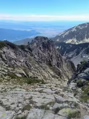
From the ridge, spectacular panoramas opened in every direction. To the north lay the broad Razlog Valley and Predela Pass, while farther west we could clearly distinguish the towns of Simitli and Blagoevgrad. On such a clear day, almost the entire Rila Mountain range stretched across the northern horizon.
I found a sheltered spot behind a rock and waited for the rest of our group before we covered the final few hundred metres together.
Standing on Pirin Peak
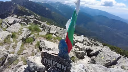
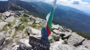
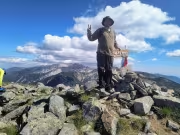
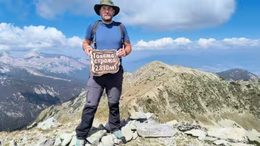
We reached Pirin Peak (2,593 m) at around 12:30 p.m., approximately three hours and forty minutes after leaving Kulinoto.
The weather could hardly have been better.
A pleasant breeze occasionally cooled us down after the demanding climb, and for a brief moment a passing cloud hid the sun, making the summit feel surprisingly cold. Minutes later, however, the sunshine returned and once again filled the ridge with warmth.
The panorama from Pirin Peak is one of the finest in Northern Pirin.
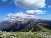
Looking west, the Struma Valley stretches from the Blagoevgrad area all the way towards Sandanski and Petrich. To the north lies the Razlog Valley, while to the east the marble peaks of Pirin dominate the skyline. Nearly the entire Rila Mountain range is visible, together with the Rhodope Mountains and numerous mountain ranges along Bulgaria's western border and into North Macedonia.
It is one of those summits where you instinctively sit down, put away your backpack, and simply enjoy being there.
A Long Summit Break
We spent more than an hour on the summit.
Lunch tasted especially good after the long climb, and nobody seemed eager to leave such a beautiful place. We even tried to take a group photo, but the family with the young girl had not yet reached the summit.
Eventually came the moment to decide how to continue.
Most of our group chose the easier option—returning to Kulinoto along the same trail.
Only five of us decided to complete the full circular route.
Looking back now, I'm really glad we made that decision. Had we descended the same way again, it would have felt like another missed opportunity. That's exactly what had happened on several previous visits, and this time we were determined not to repeat the same mistake.
Descending Towards Pleshki Peak
Leaving Pirin Peak behind, we continued south along the ridge towards Pleshki Peak.
Although Pleshki is only about fifty metres lower than Pirin, the descent to the saddle between the two peaks is far from pleasant.
Calling it a trail is actually being generous.
The route winds through dense dwarf pine and loose rocks, requiring careful footing almost every step of the way. In several places we had to stop and look around before deciding which direction to take. Small stone cairns marked the route, but they were sometimes difficult to spot among the rocks.
The last time I had crossed this section had been seven years earlier, and my memory of the exact route had faded considerably.
Fortunately, we eventually reached the saddle without any problems before making the short climb to Pleshki Peak.
Looking back, we could see the smaller group we had overtaken earlier carefully making their way down the same rocky slope.
Bezimenen Peak
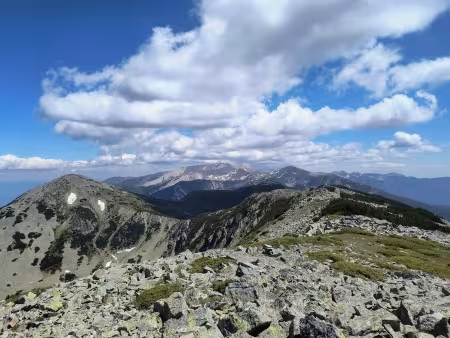
From Pleshki Peak, Bezimenen Peak (2,596 m) lies less than a kilometre away.
Some of us briefly considered bypassing the summit using the lower contour trail. However, I remembered hiking that alternative route about ten years ago and knew that climbing the summit itself was actually the better option.
The ascent proved to be quick and straightforward.
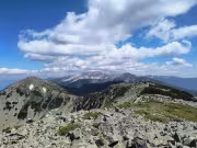
Reaching Bezimenen rewarded us with an even better perspective of Pirin's famous marble ridge. From here the dramatic white limestone peaks dominate the southern skyline, creating one of the finest viewpoints on the entire route.
We reached the summit at around 2:50 p.m.
Among our group, I was the only one who had previously completed this traverse, so visiting every summit felt almost obligatory. Besides, everyone agreed that the views from Bezimenen were too good to miss.
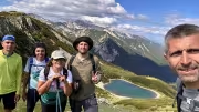
After taking a few photos and, naturally, several selfies, we continued towards the final major objective of the day.
The Ridge Towards Dautov Peak
The section between Bezimenen and Dautov is arguably the most technical part of the entire hike.
The trail remains visible throughout, generally staying just below the ridge on its western side. To the left, however, the terrain drops away steeply, demanding constant attention. While the route never requires climbing or technical equipment, careless footing could easily have unpleasant consequences.
We continued carefully, maintaining a steady pace.
Eventually the lower bypass trail joined us from the right before the route descended gradually along the ridge. A little farther on, the path turned right into a corridor through dense dwarf pine that had obviously been cleared some years ago.
Soon we emerged beneath the final climb to Dautov Peak.
The Final Summit of the Day
After such a long day in the mountains, the last ascent always feels tougher than it actually is.
We stopped for about ten minutes at the foot of the mountain, enjoying a short rest before tackling the final climb.
Fortunately, Dautov Peak rises only modestly above the saddle, and we reached the summit in less than twenty minutes.
It was just before 4:00 p.m.
That meant the hike from Bezimenen Peak to Dautov Peak had taken almost exactly one hour.
The afternoon light was now beginning to soften, creating ideal conditions for photography.
Sunlight illuminated the marble ridge of Northern Pirin, making the white limestone glow against the deep blue summer sky. In the distance, the famous peaks of Vihren and Kutelo peeked over the surrounding ridges, while Koteshki Chal stood proudly in full view.
The complex landscape of ridges, cirques and marble summits seemed almost endless.
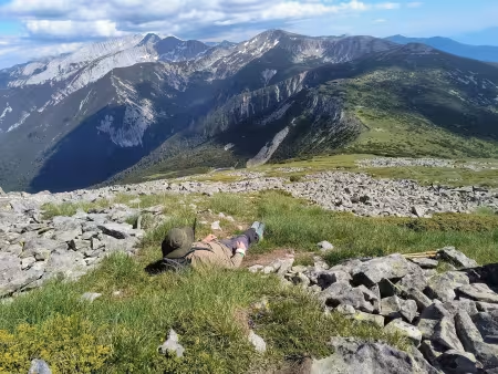
Despite the magnificent scenery, a strong wind swept across the summit. Since I was still sweating from the climb, I preferred to find a sheltered place about thirty metres below the top.
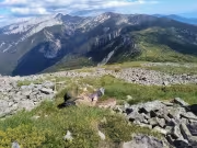
Lying back against a warm rock, protected from the wind, I simply relaxed and admired one of the finest mountain panoramas Northern Pirin has to offer.
Descending Towards Dautovo Lake
After spending some time on Dautov Peak, we finally began our descent.
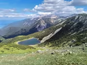
The trail initially drops back to the saddle before continuing towards Dautovo Lake. Interestingly, the lake cannot actually be seen from the summit itself. Only after descending a little farther does it suddenly appear below, tucked away beneath the surrounding slopes.
Naturally, we stopped once again to admire the view and take a few more photographs.
The narrow path leading down to the lake isn't particularly well defined, but navigation is straightforward. There are no difficult sections, and the direction of travel is obvious.
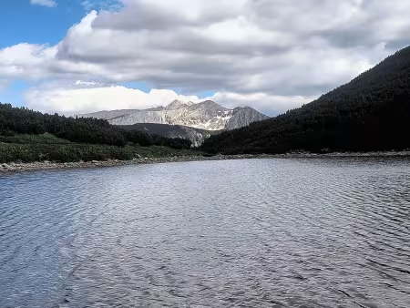
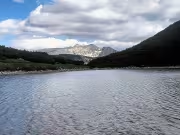
Standing beside the lake, I couldn't resist taking another photograph. Surrounded by rocky slopes and dwarf pine, Dautovo Lake feels wonderfully isolated—a peaceful place after the rugged ridge walk.
Several members of our group were running low on water, so they refilled their bottles directly from the lake. The water was crystal clear, fed almost entirely by melting snow. Later in the summer, however, the lake often shrinks considerably and may even dry out during particularly dry years.
Towards Ushitsite
Leaving the lake behind, we followed the left-hand trail towards Ushitsite, where the route joins the famous E4 European Long Distance Path.
This section gently undulates through dense fields of dwarf mountain pine before eventually descending towards the saddle.
The last time I had walked this trail was seven years earlier. Back then, the corridor through the dwarf pine had been freshly cleared, making walking easy.
Nature, however, never stands still.
Although the trail remains perfectly passable today, the dwarf pine has gradually begun reclaiming it. In several places we had to duck beneath overhanging branches that were beginning to narrow the path once again.
Since this trail forms part of the Pirin Ultra 160 km race, I expect it will continue to receive occasional maintenance.
Joining the E4 Trail
Once we reached Ushitsite, the route became noticeably more familiar.
From here onward we followed the well-established E4 trail back towards Kulinoto.
Initially the path continues through dwarf pine before gradually re-entering the forest. As the trees became taller, the descent grew gentler and far easier on tired legs.
Joking among ourselves, we laughed that we had finally left the "unofficial dwarf pine" behind and returned to the "official dwarf pine" found along the maintained hiking trail.
Somewhere in the forest we caught up with another hiking group we had previously seen near Dautov Peak while we were still on Bezimenen.
After exchanging a few friendly greetings, we continued downhill at our own pace.
The Final Kilometres
Eventually the hiking trail joined the same forest road we had walked that morning.
There is one shortcut that leaves the road, but despite being slightly shorter, it is considerably steeper. After nearly twenty-three kilometres in the mountains, none of us found the idea particularly appealing.
Sometimes the easier option really is the better one.
Once back on the forest road, only about one and a half kilometres remained before reaching Kulinoto.
Those final minutes always bring mixed emotions.
The satisfaction of completing a demanding mountain adventure blends with the quiet realization that an unforgettable day is slowly coming to an end.
Back at Kulinoto
At the spring near the picnic area where we had left our cars, we found several members of our original group waiting for us.
Some had returned almost forty minutes earlier, while the family hiking with the young girl had arrived only moments before we did.
We exchanged stories from the day, compared our different experiences, and laughed about the challenges we had all overcome.
Soon afterwards it was time to say goodbye.
Our friends headed back towards Petrich, while we drove home to Blagoevgrad, already talking about future adventures in the mountains.
Is This Hike Worth It?
Without hesitation—yes.
This is one of the finest circular hikes in Northern Pirin and one of the most rewarding mountain routes I've completed in recent years.
It is certainly not an easy hike. The elevation gain is significant, the terrain is demanding, and several sections require careful footing over rocky moraines and narrow ridges. Good physical fitness, mountain experience, and suitable weather conditions are essential.
At the same time, these very challenges are what make the route so memorable.
Unlike some of Pirin's better-known trails, this circuit remains surprisingly quiet. For much of the day we encountered only a handful of other hikers, allowing us to enjoy the mountains in peace.
The combination of dense forests, ancient Macedonian pines, wild glacial cirques, panoramic summits, marble ridges, Dautovo Lake, and even our unexpected meeting with two curious fox cubs created an experience we'll remember for years.
If you're looking for a challenging full-day adventure that showcases a quieter and wilder side of Pirin National Park, this circular hike deserves a place at the very top of your list.
Sometimes the longest days in the mountains become the ones you remember forever.
If you're planning this hike, start early, carry plenty of water, check the weather forecast carefully, and allow yourself enough time to enjoy the scenery rather than rushing through it.
The summits will still be there—but the best memories often come from the moments in between.

Add new comment