
In the summer of 2020, we took this route, then our hike was from the Macedonia hut to Semkovo along the ridge. Now we decided to start from Semkovo to Kanarata Peak and return via Vapski Lakes, also climbing Rejepitsa Peak.
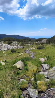
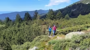
We left Blagoevgrad shortly after 7:30 a.m. and arrived at the Semkovo hut around 9:30 a.m. From there to the upper Vapski Lake, we had 6 kilometers with a 600-meter elevation gain ahead of us. The trail to the lakes is marked with white and yellow markings. It first follows the dirt road that leads to the Vapa canton, but at one point the trail turns right and goes through the forest. You can continue along the road, but it is a longer route.
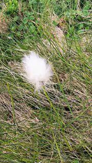
Video from Hiking to Kanarata Peak from Semkovo via Vapski LakesThe trail comes out onto the road before the canton and turns right again into the forest. At times it is steeper, at times it levels out, but overall there is an elevation gain to overcome. At one point, you exit the forest and the trail begins to wind along a stream, but overall it is well cleared, although there was tall grass and some thorns, and I made the mistake of wearing shorts.

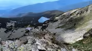
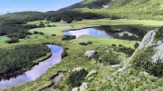
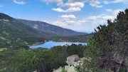
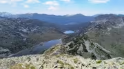
The trail passes slightly to the side of the lower Vapsko Lake, so if you want to see it, you have to veer slightly to the left. I stopped for one photo and continued up to the upper lake, which is a 5-10 minute walk away. We reached the upper Vapsko Lake a little before 11:30 a.m. – 2 hours after the start of our hike, while the sign at the hut said it would take 3 hours.
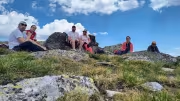
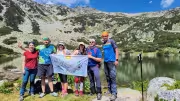
We took a long break at the lake, maybe half an hour. There we met a large group from Plovdiv – TD Ruen. Some of the group stayed to rest at the lake, while others set off to climb the ridge and from there to Kanarata Peak.

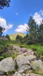
We rested, had a light snack, and then took the path up to the ridge – another 1.2 km with an elevation gain of about 250 m. In about 30-40 minutes, we reached the ridge, where we caught up with the large group. There was also another small group that had set out to put up new signs on Kanarata and Yosifitsa.
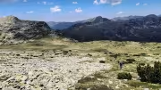
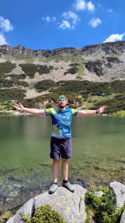
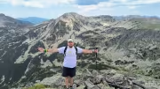
The other groups continued on to Kanarata Peak, while we turned left toward Rejepitsa Peak. After about 30 minutes, we were at the peak, but not at the very top. A little south of the peak, there is a white metal cross, from where you can see Lake Rejepsko below very well. We took our lunch break there, ate, and took pictures at the cross.

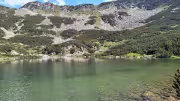
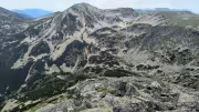
We also passed the exact peak of Rejepitsa and veered slightly west to see the Karaalanishki Lakes and the highest peak in central Rila towering above them – Karaalanitsa Peak (Cherna Polyana).

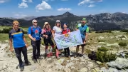
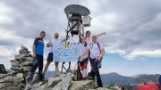
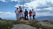
It was time to descend to the trail coming from Grunchar and continuing to Ribnizera or the Macedonia hut. Just below Kanarata Peak, the trails split. From where the trails split, there is also an unmarked trail that took us from the peak, which we climbed in about 20-25 minutes. Just as we reached the peak, the other groups were leaving, at least they made room for us to take pictures.

We didn't linger long at Kanarata, as time was passing and we had to return. Initially, we thought of descending either through the Dry Lake or through the Karaalanichski Waterfall to Semkovo. However, tourists we met told us that the trails were not well cleared, so we decided to return the way we came—through the Vapski Lakes.
We arrived at the Semkovo hut shortly before 5:30 p.m. We completed today's entire hike in 8 hours, covering a distance of 20+ km and 1,200 meters of elevation gain.
Add new comment